Using GIS to Locate Spiranthes diluvialis: A Report
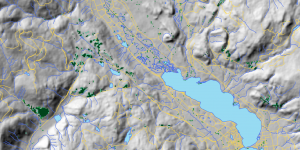
As the GIS analyst, my job was to prepare a map that will help a botanist locate Spiranthes diluvialis in the Okanagan Valley area. Therefore, I produced a multi-criteria model that highlights potential habitat and helps direct her search efforts.
Anthropogenic Impacts on Southern Resident Killer Whales: Implications for Conservation Strategies
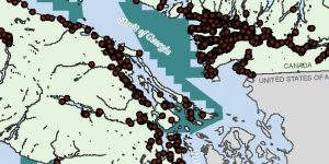
An analysis was conducted to determine the geographical scope of three threats to Southern Resident Killer Whales: Chinook salmon commercial catches, tanker traffic and contaminated properties. A series of GIS analysist functions, such as unifying projections, select-by-attribute, clip, SQL queries, buffer, and polygon intersects were applied to the datasets. The purpose of our project is to highlight the significant disruptions found while encouraging conservation strategies.
Garibaldi Ski Resort near Squamish: An Environmental Impact Assessment
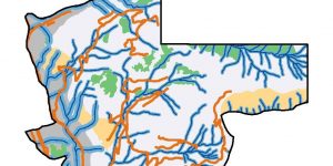
This memo delves into an environmental impact assessment of the proposed ski development on Garibaldi mountain near Squamish British Columbia. Areas of concern are Old Growth Forests, Ungulate Habitat and River Riparian zones. Furthermore, some climate change implications for the project are discussed.
Analyizing Housing Costs in Metro Vancouver
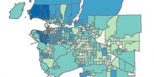
This project investigated the housing costs in Metro Vancouver using census data collected from both 2011 and 2016. Census spatial data was downloaded and tabular data was joined to each layer using ArcMap. The project explored four different classification methods as well as data suppression, uncertainty of using different variables and the ethical implications of analysis.
A Pollinator Project: Andrena angustitarsata Interactions by Plant Family
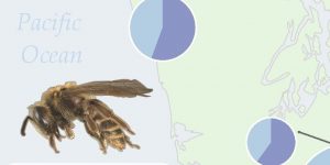
This will be a future post about the Final Project I did in Cartography Geob 372
Storm Surge Analysis for the Metro Vancouver Area
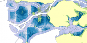
In this week’s lab, I have been tasked with analyzing Vancouver’s storm surge risk.